


Gardanne - Gréasque : randonnée au pays minier
Contact
For information
General information
Opening times and Prices
All year round.
Prices
Free access.
Guidebook with maps/step-by-step
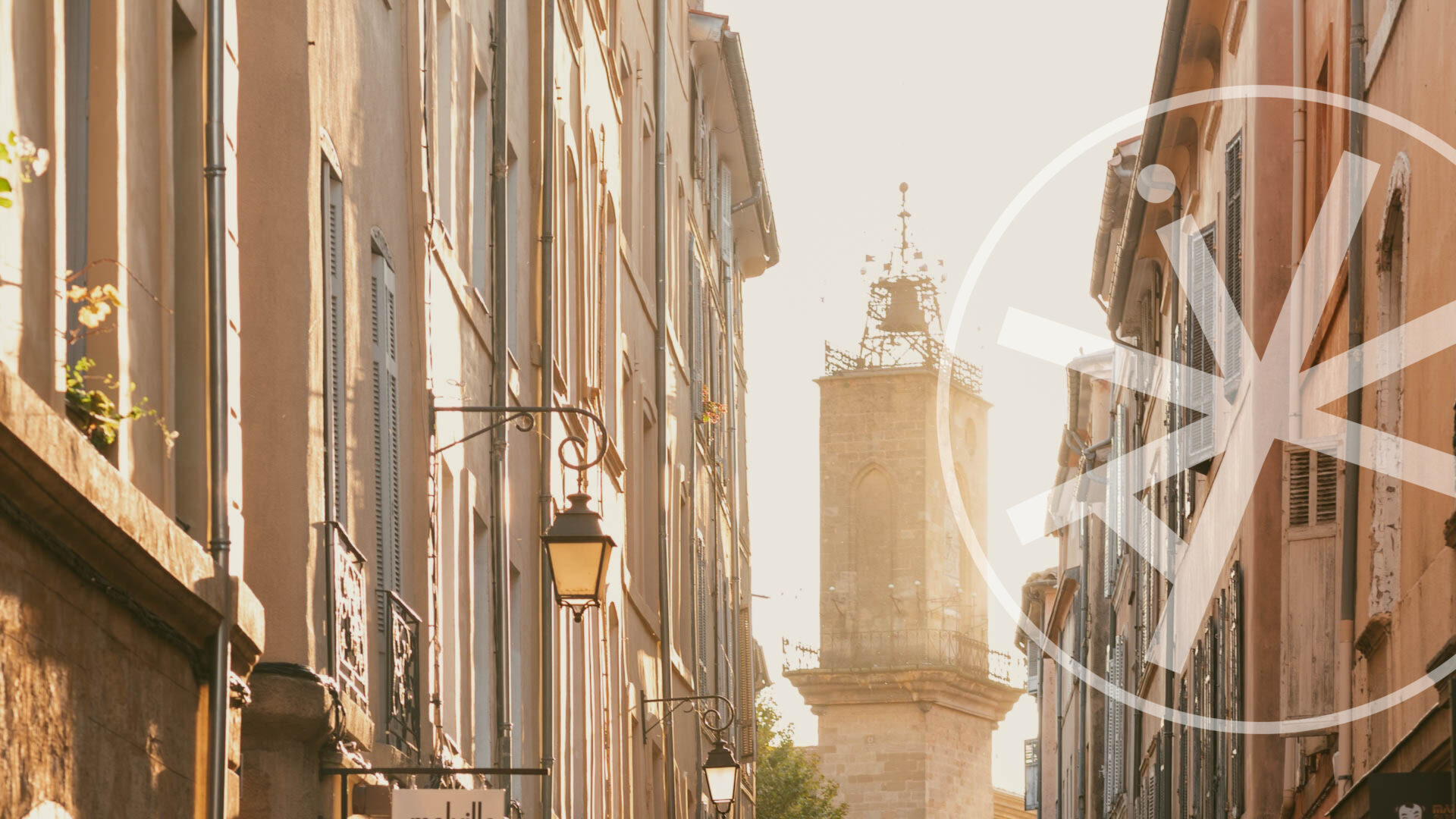
1. From the station, go to the Phocéens roundabout. Go around it on the left to reach the boulevard Carnot. Start the GR2013 signposting on the left-hand pavement, which you will follow for a tour of the old town: Place Gueydan, on the left Faubourg de Gueydan, on the right rue Marceau, on the right rue Puget, on the left rue Courbet, the wash house, on the left the Saint-Valentin chapel and at the top of the stairs, Cézanne's bell tower. Beautiful view of Gardanne, Sainte-Victoire and the Etoile mountain range. Then, in rue de la Vieille Eglise, go down the stairs on your right which pass under the Bel-Air gate (yellow markings), turn right, left and then left again in rue Bel Air (GR2013 markings). Go down the stairs of the Montée du Castrum to the right and arrive at the Place Planet doù Pastre Micheù, then go down Rue Ledru Rollin and arrive at the Place de la Liberté in front of the Town Hall.
Turn left into the Cours de la République and at its right-hand end (fountains), continue in the direction of the Lycée M.M. Fourcade.
2. Pass under the porch of the high school and follow the vallat (stream) of Saint-Pierre. Go through the tunnel, cross the road and, opposite, follow the yellow line all along the circuit. Pass a children's playground and a mini sports course. Further on, cross the stream and keep to the right until you reach a tarmac road which you turn left onto. After the ranch and a last house, the road becomes a shady path that winds flat through the pine forest for 20 minutes before joining a track that you follow straight south-east, on the right bank of the intermittent stream carpeted with violets in spring. Pass under the HV line and at the junction, descend on the right-hand track with the yellow to reach a right-angle bend.
3. From here, an unmarked return trip (2.7 km, 45 min, den. 97 m) to the Puits Hély d'Oissel in Gréasque is possible.
Climb the stony path on the left (green cross on a rock to the left of the pine tree). Follow it to the east until you reach a small road that you cross and continue opposite the path that goes to the right and descends to the car park of the Puits d'Hély d'Oissel, a former lignite extraction well from 1922 to 1962, 450 m deep!
4. You can visit the Mine Museum.
Then, retrace your steps (not signposted) to find the right-angle bend you left earlier.
Follow the rising path with excellent yellow (+ green) markings which you follow for a long time through the hilly and shady countryside on small roads and paths...
Go down along the restanques and take on the left between two fields the caladé path which arrives on a small road at Font Belle. There is a breathtaking view of the Grand Puech de Mimet and the ridges of Baou Traouca. Walk along the children's playground and go down to the right immediately after the barrier. At the road, turn right and then left on the GA 100 track, well marked in yellow. It mainly follows the hilly ridge to the west (right) in the shade of the tall pines. At the cistern, a beautiful view of the Grand
Puech and Mimet (the highest village in Bouches-du-Rhône).
Further on, the Pilon du Roi to the south and the Gardanne thermal power station to the north.
At point 300, leave the track and go straight down to the right on a path through the trees. You will arrive at the Canal de Provence.
5. Follow the winding canal with Sainte-Victoire in the background.
At a crossroads, leave the bank and with the yellow (+ red), join the D7 (be careful!) and Gardanne by the Chemin du Claou. At the end of the road, turn left onto Avenue des Aires and find the Gr2013 markers. At the large pylon, turn right, then right again at the Château Pitty bus stop. Walk down the one-way street and turn left again through the tunnel (the circuit's junction), then follow the route in the opposite direction to the Cours de la République and its fountains.
Walk past the town hall and the war memorial, continue on the boulevard Forbin and the boulevard Bontemps. Admire the Gueydan fountain. Finally, the boulevard Carnot will take you back to the station.
Données du circuit
Données du circuit
- Distance : 22km
- Durée estimée : 06h30
- Dénivelé : 397m
- Dénivelé positif : 397m
- Dénivelé négatif : 397m
- Balisage : Jaune, GR de Pays (Jaune/rouge)
Tracé(s) GPS
Salles de réunion
Show map
Gardanne - Gréasque : randonnée au pays minier
Gare SNCF de GardanneAvenue de la gare
13120 Gardanne


